Show summary Hide summary
Summary:
- A signed 468 km route crossing 17 municipalities in northern Brazil.
- Frequent wildlife encounters in several sections of the trail.
- Stretches passing through quilombola communities.
- Navigation supported by the official eTrilhas app.
- Ideal for travelers drawn to slow, grounded experiences.
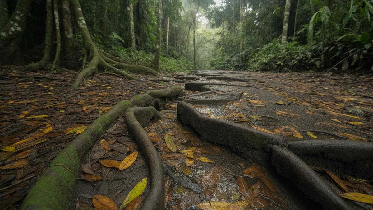
When Brazil introduced the Amazônia Atlântica Trail, the announcement only hinted at the atmosphere travelers would meet once they stepped onto the path. The route begins in the historic center of Belém, then the city slowly fades behind you. The air thickens, leaves rustle overhead, and villages appear where daily life still depends on the forest. Over 468 km, the scenery shifts often, offering travelers a clear view of how people live with the Amazon. The pace is unhurried, and the changes of landscape feel like a gentle invitation rather than a spectacle.
This project was built on a simple idea: open a long, accessible trail without overwhelming the places it crosses. Travelers can walk, cycle or ride with the support of the eTrilhas app. What stands out is the rhythm of the journey, shaped by encounters, weather, and the quiet movement through Pará. Let’s take a closer look at what this new route reveals.
Bhutan: the country that quietly slows you down (and you’ll thank it for)
Europe in 2026: the trips worth planning around real dates
A trail linking forests, villages and daily life
The Amazônia Atlântica Trail is now the longest marked route in Latin America. It crosses 17 municipalities and 13 protected areas, including stretches bordering quilombola territories. These communities maintain traditions passed down across generations, and the trail simply moves through their world without trying to frame it as a spectacle.
The scenery changes gradually. One hour you walk under a dense green canopy, the next you arrive near a river where fishermen prepare their nets. These transitions give the trail continuity and reveal the diversity of Pará’s landscapes.
A visitor-friendly initiative
To make the trail easier to navigate, Embratur created a multilingual platform dedicated to national parks. The Amazônia Atlântica Trail is among its highlighted routes, helping international travelers plan their visit with more confidence.
Meeting the communities along the route
Many visitors remember the people they met along the trail as vividly as the places themselves. Villagers sometimes invite travelers to join simple activities: gathering fruits, participating in small farming tasks or trying artisanal fishing. These moments offer a look into how families interact with their environment.
Traveler’s note
Sharing these activities helps travelers understand local ways of living and makes the journey feel more rooted in reality.
Local tip
In several communities, artisans create items from natural fibers or seeds. Buying directly from them supports local craftsmanship and provides meaningful income.
Wildlife you may encounter
The forest often reveals itself without warning. Groups of monkeys move freely between branches, sloths cling to tree trunks, and flashes of color announce toucans or macaws. On wetter sections, tracks left by tapirs or capybaras sometimes appear along the ground, and giant otters gather near calm riverbanks.
Frequent sightings
- Monkeys
- Sloths
- Toucans and macaws
- Capybaras
- Coatis
- Tapirs
- Giant otters and caimans
Wildlife is part of the trail’s identity, and keeping a respectful distance protects both visitors and animals. The trail is their territory first.
What this means for you
Some travelers may come across spiders, including tarantulas, especially at dusk. They remain calm when not disturbed. Closed shoes and a small headlamp usually offer enough reassurance for those who prefer avoiding surprises.
Navigating the trail with the eTrilhas app
The eTrilhas app serves as a reliable companion. It provides maps, suggested stages, environmental guidelines and emergency contacts. For a long-distance route, having a clear reference point makes the experience smoother.
Checklist
- Download the app before starting your journey.
- Plan water and food supplies.
- Check local weather and trail access.
- Carry a basic first-aid kit.
- Tell someone where you expect to end your day.
Budget insight
Reynisfjara right now: what changed on Iceland’s black sand beach
Europe’s 2026 travel shortlist: Madeira, Tbilisi, Milan, Glasgow
Meals and accommodation in villages remain reasonably priced. Hospitality is modest but welcoming, and staying in these communities helps support local economies. Renting bicycles or horses may involve additional costs depending on availability.
A project built with local participation
Authorities expect more than 10,000 travelers to walk at least part of the trail in the coming year. What makes this initiative meaningful is the involvement of the people who live along its route. Their participation shapes how tourism grows and ensures the benefits stay close to home. The trail feels more like a shared space than a tourist product.The Amazônia Atlântica Trail does not aim for grandeur. It invites travelers to slow down, listen and pay attention to the places and people who define Pará. For those looking for a quieter, more grounded way to experience northern Brazil, this long-distance path offers a genuine and accessible entry point.